











































BIM and GIS Integration: How It Improves Construction and Infrastructure Planning

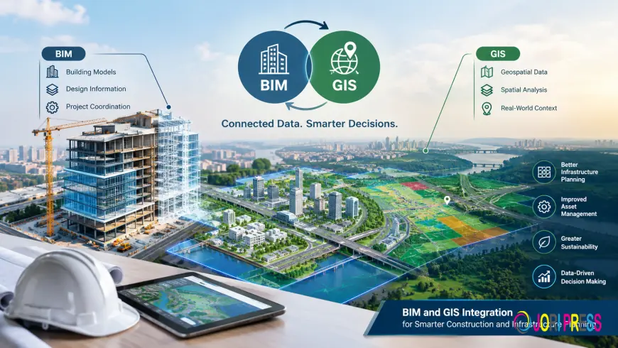
BIM and GIS Integration: How It Improves Construction and Infrastructure Planning
Construction and infrastructure projects involve more than designing individual buildings. Project teams also need to understand how buildings, infrastructure, and their surrounding environments relate to one another. When building information and geographic information are considered together, professionals can develop a clearer understanding of project requirements and spatial relationships.
This is where Building Information Modeling (BIM) and Geographic Information Systems (GIS) integration becomes relevant.
BIM provides digital representations of buildings and their associated information, while GIS focuses on geographic locations and spatial information. Bringing these two approaches together helps connect building-level information with its wider geographic context.
For architects, BIM managers, civil engineers, infrastructure developers, and GIS professionals, understanding this relationship is an important step towards better-informed construction and infrastructure planning.
What Is BIM and GIS Integration?
BIM and GIS integration involves connecting building information with geographic information so that project teams can understand both the details of a built asset and its location within a larger environment.
BIM supports the representation of building elements and project information. GIS helps organize and interpret geographic and spatial information.
When these two sources of information are integrated, professionals can examine building models in relation to their surrounding areas rather than considering each source of information separately.
This connection is relevant to the Architecture, Engineering, and Construction (AEC) industry, infrastructure projects, and other applications where building information and geospatial data need to work together.
However, integration requires careful consideration of how information is prepared, organized, and connected. The objective is to make the relevant information useful for the requirements of a particular project.
Why Is BIM and GIS Integration Important for Construction Planning?
Construction planning requires an understanding of the building or infrastructure asset as well as its surrounding environment.
When building models and geographic information are considered independently, teams may need to work across different sources of information to understand the overall project context.
BIM and GIS integration provides a way to connect these perspectives.
1. Connect Building Information with Geographic Context
A building model provides information about the asset, while geographic information helps establish where that asset is located in the wider environment.
Integrating BIM and GIS makes it possible to consider these two perspectives together.
This is particularly relevant to projects where buildings, surrounding infrastructure, and geographic conditions need to be considered as part of the planning process.
For project teams, connecting building information with spatial context can support a more comprehensive understanding of the project.
2. Support Infrastructure Planning
Infrastructure projects often involve assets and locations that extend beyond an individual building.
GIS provides geographic context, while BIM provides building and model information. Integrating these sources helps professionals consider infrastructure information alongside the wider project environment.
This relationship is relevant to infrastructure planning, where understanding spatial relationships is an important part of evaluating project requirements.
For civil engineers, infrastructure developers, and planning teams, BIM and GIS integration offers a way to bring different types of project information into a connected workflow.
3. Improve the Accessibility of Project Information
Project information becomes more useful when the right people can understand how different datasets relate to one another.
Connecting BIM models with GIS information helps establish a relationship between building-level information and geographic data.
This can be valuable for multidisciplinary teams working with different forms of engineering and spatial information.
The practical requirements will depend on the project, including the information available, the formats being used, and the intended purpose of the integration.
How Does BIM and GIS Integration Work?
The integration process depends on the project requirements and the source information available. A useful starting point is to understand which datasets need to be connected and how they will be used.
Step 1: Identify the Required Information
Begin by identifying the building models, drawings, and geographic datasets relevant to the project.
The objective is to establish which information needs to be connected and what the integration is expected to support.
Clear requirements help project teams determine the appropriate workflow.
Step 2: Assess the Source Data
Before integrating different datasets, teams need to understand their structure, formats, and suitability for the intended use.
Building models and geographic datasets may organize information differently. These differences should be considered when planning the integration process.
Step 3: Determine the Appropriate Integration Workflow
The required workflow depends on the type of source data and the project objectives.
For example, a project may require CAD-to-GIS conversion, BIM-to-GIS conversion, or a Scan-to-GIS workflow.
Each approach addresses a different source of information, so the appropriate method should be selected according to the project requirements.
Step 4: Check the Integrated Information
Once the information has been processed, it is important to assess whether the resulting datasets meet the intended requirements.
Project teams should consider the relevance, consistency, and usability of the integrated information before relying on it for further work.
A clearly defined workflow helps establish expectations for the final deliverables.
What Are the Applications of BIM and GIS Integration?
BIM and GIS integration can be relevant to several areas where building information and geographic data need to be considered together.
Infrastructure planning: Connecting building models with geographic information helps teams examine assets within their wider spatial context.
Urban planning: Integrating building-level information with geographic data can support a broader understanding of the built environment.
Asset management: Connecting asset information with geographic context can help teams understand the relationship between physical assets and their locations.
Facility management: Integrated information can provide a connection between building-related data and the geographic context of a facility.
Digital twin initiatives: BIM and GIS integration is relevant to digital twin workflows that bring together model information and spatial data.
The precise applications depend on the available data, project objectives, and the scope of the integration.
Common Considerations Before Starting a BIM and GIS Integration Project
Although BIM and GIS integration offers a way to connect different types of information, project teams should consider several practical requirements before selecting a workflow.
Source data: Identify the available BIM models, CAD drawings, and geographic datasets.
Coordinate alignment: Consider how the building model and geographic information will be positioned relative to one another.
Data compatibility: Assess whether the available formats and data structures are suitable for the intended integration.
Project objectives: Define what the integrated information needs to support, whether it involves infrastructure planning, spatial analysis, or asset-related applications.
Deliverables: Establish the expected output and how the project team will use the resulting information.
Addressing these considerations early can help teams choose a workflow that aligns with their actual project needs.
Choosing a BIM and GIS Integration Service
Organizations evaluating BIM and GIS integration should begin by identifying their source data, project objectives, and required deliverables.
The right service approach depends on the type of information involved and how it needs to be used.
For example, projects involving existing CAD drawings may require CAD-to-GIS conversion, while projects involving building information models may require BIM-to-GIS conversion. Other requirements may call for a Scan-to-GIS workflow.
Understanding these differences helps organizations identify the appropriate solution instead of treating every integration requirement as the same problem.
Conserve Solutions provides GIS Implementation for BIM as part of its digital services. Organizations exploring this area can review the service details to understand its relevance to their project requirements.
Conclusion: Connecting Building Information with Geographic Data
Construction and infrastructure planning involves understanding both individual assets and their surrounding environments. BIM and GIS integration provides a way to connect building information with geographic data, helping project teams consider these different perspectives together.
From infrastructure planning and urban development to asset management and digital twin initiatives, the relevance of integration depends on the information available and the objectives of the project.
The starting point is to identify the required datasets, understand the integration requirements, and select a suitable workflow for the intended deliverables.
Conserve Solutions offers GIS Implementation for BIM as part of its digital services portfolio. For organizations exploring ways to connect building information with geographic data, visit the service webpage to learn more:
What's Your Reaction?
 Like
0
Like
0
 Dislike
0
Dislike
0
 Love
0
Love
0
 Funny
0
Funny
0
 Angry
0
Angry
0
 Sad
0
Sad
0
 Wow
0
Wow
0