


Underground Utility Mapping: Precision, Safety & Smart Planning
Beneath our feet lies a complex labyrinth of utility lines—gas pipes, water mains, fiber-optic cables, sewage systems, and electrical conduits—all silently supporting our modern lives. Yet, these essential networks are often out of sight and, without proper planning, out of mind. That’s where underground utility mapping steps in—a sophisticated process that transforms the unseen into the known, reducing risks and enabling safer, smarter infrastructure development.
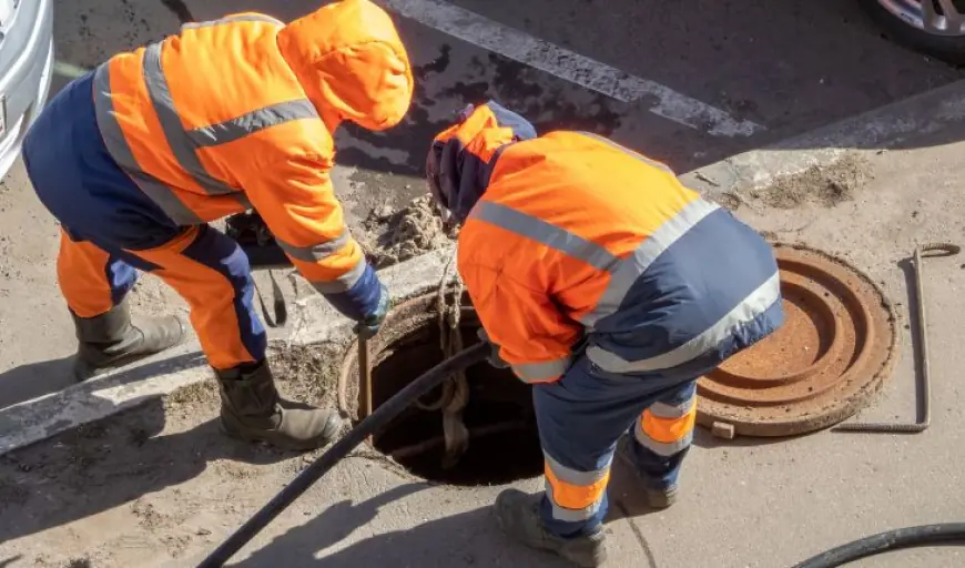
At its core, underground utility mapping is the process of identifying, locating, and documenting underground utilities using various detection methods and advanced geospatial tools. It plays a vital role in urban planning, construction, roadwork, excavation, and maintenance projects. More than just a technical process, it is a protective measure that prevents accidents, service disruptions, costly delays, and legal liabilities.
Expert Market Research Insight: Mapping the Future with Confidence
According to Expert Market Research, underground utility mapping industry has become increasingly critical in today's infrastructure landscape, especially with the expansion of urban environments and redevelopment of aging cities. Their insights highlight the growing reliance on technologies such as Ground Penetrating Radar (GPR), electromagnetic detection, and 3D geospatial modeling to minimize excavation risks. By offering a clearer picture of what lies beneath the surface, utility mapping empowers engineers, planners, and contractors to proceed with confidence and precision. As infrastructure projects grow in complexity, Expert Market Research underscores the essential role of utility mapping in ensuring safety, efficiency, and regulatory compliance across industries.
Why Accuracy Matters in Subsurface Discovery
Imagine planning an excavation for a new metro line or laying fiber optic cables, only to accidentally rupture a gas pipeline or cut into a power line. The consequences could be disastrous—both in terms of safety and financial impact. That’s why accuracy in underground utility mapping isn’t just helpful—it’s crucial.
Modern mapping combines traditional survey techniques with cutting-edge technology to deliver data that is both precise and actionable. From handheld electromagnetic locators to drone-mounted sensors and LiDAR-enhanced mapping systems, the tools now available ensure that planners don’t have to dig blindly. Every inch of mapped space is one less inch of uncertainty.
India’s Growing Reliance on Smart Subsurface Mapping
In India, with its rapidly evolving urban centers and massive infrastructure rollouts, underground utility mapping is becoming indispensable. Cities like Mumbai, Delhi, and Bengaluru are increasingly depending on mapping to manage dense utility networks, prevent accidental damages, and coordinate between multiple civic bodies. The country’s Smart City Mission and urban redevelopment projects have particularly highlighted the importance of digital subsurface records.
By integrating GIS (Geographic Information Systems) with high-resolution mapping data, municipalities and developers are now able to build resilient infrastructure that aligns with the underground reality—avoiding costly surprises during excavation or construction.
Technology at the Helm: Tools That Transform the Underground
Underground utility mapping has undergone a remarkable transformation, thanks to the integration of advanced detection and visualization technologies. Tools such as GPR (Ground Penetrating Radar), which uses radar pulses to image the subsurface, have made it possible to detect utilities with exceptional clarity—even in challenging terrains.
Electromagnetic locators help trace metallic utilities, while inertial navigation systems and real-time kinematic GPS allow for highly accurate geo-positioning. These technologies come together to produce layered maps that depict depth, material, orientation, and path—all essential details for engineers and contractors.
3D visualization and Building Information Modeling (BIM) integration further enhance understanding, allowing teams to simulate and plan activities around existing utility layouts with unparalleled precision.
Beyond Construction: The Wider Role of Utility Mapping
While most people associate underground utility mapping with construction projects, its impact extends far beyond. It plays a crucial role in disaster management—helping emergency teams understand what lies beneath before digging to rescue trapped individuals or restore services.
Similarly, utility mapping is used for preventive maintenance. Municipalities can assess aging pipes or cables and proactively upgrade them before failures occur. It’s also vital in environmental monitoring and urban agriculture planning, helping identify contamination sources or safe zones for planting.
Additionally, utility mapping supports legal and regulatory compliance. Many jurisdictions now require accurate utility maps before issuing excavation permits, making the process not just best practice, but mandatory.
A Safer Tomorrow Starts Below the Surface
The hidden world beneath our cities holds immense potential—and immense risk. As we continue to build higher, dig deeper, and expand wider, understanding what’s underground has become a foundational step in responsible development.
Underground utility mapping is not just about avoiding damage—it’s about building with intelligence, ensuring the safety of workers and residents, and creating infrastructure that truly stands the test of time. When we map what lies beneath, we pave the way for a smarter, safer, and more connected tomorrow.
What's Your Reaction?
 Like
0
Like
0
 Dislike
0
Dislike
0
 Love
0
Love
0
 Funny
0
Funny
0
 Angry
0
Angry
0
 Sad
0
Sad
0
 Wow
0
Wow
0