


Elevating Commercial Real Estate with Drone Photography
The landscape of commercial real estate marketing has undergone a significant transformation, with the advent of advanced visual technologies. Among these, Drone Photography has emerged as a cornerstone, providing a unique and powerful way to showcase properties. Unlike traditional ground-level photography, which offers a limited perspective, aerial imagery captures the full scope of a commercial property, highlighting its scale, location, and key features. This capability is particularly crucial in the commercial sector, where a property's value is often tied to its infrastructure, surrounding amenities, and logistical advantages. This guide delves into how drone technology can be leveraged to create compelling visual narratives that attract investors, tenants, and buyers, solidifying its role as an indispensable tool for modern commercial real estate photography.
The Strategic Value of Aerial Perspectives
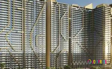
In the realm of commercial real estate, a picture is not just worth a thousand words; it's worth millions in potential investment. Drones provide a strategic advantage by offering a birds-eye view that showcases the entire property, including parking lots, access roads, and neighboring businesses. For large industrial sites, warehouses, or sprawling retail complexes, this panoramic view is essential for conveying the property's immense size and potential. A drone can capture the layout of a business park, the proximity to major highways, or the relationship between different buildings on a campus. These details are critical for a potential buyer or tenant to assess a property’s functionality and strategic value.
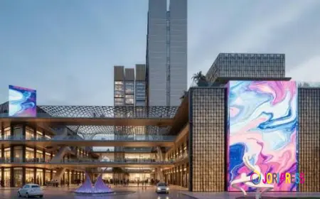
Beyond providing a comprehensive overview, aerial photos and videos can reveal unique selling points that are invisible from the ground. A property with a distinctive roofline, a meticulously landscaped courtyard, or a private waterfront access can be beautifully highlighted with a drone. This kind of visual storytelling not only makes a listing stand out but also provides a more immersive experience, allowing clients to visualize the property's full potential and its place within the community. The visual context provided by drones builds a powerful and persuasive case for the property.
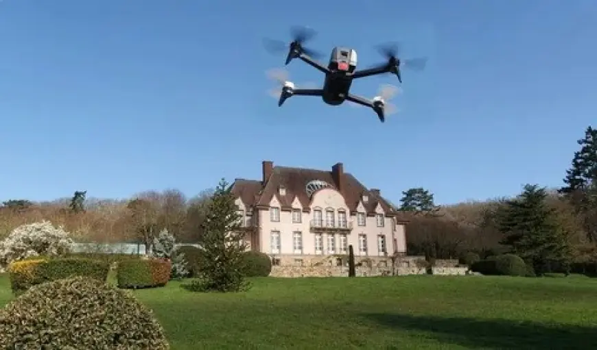
Mastering the Art of the Commercial Drone Shoot
Executing a successful drone photoshoot for a commercial property requires meticulous planning and a deep understanding of both photography and flight operations. One of the first and most important steps is a thorough site assessment. This involves identifying key features to highlight, scouting for potential obstacles like power lines or trees, and planning flight paths to ensure safety and capture the best angles. The timing of the shoot is also crucial. While the "golden hour" (just after sunrise or before sunset) provides soft, warm light for residential properties, commercial shoots often benefit from midday light, which minimizes shadows and provides clear, detailed shots of buildings and surrounding areas.
Professionals in commercial real estate photography must also have the proper credentials and equipment. An FAA Part 107 certification is mandatory for all commercial drone operations in the United States, ensuring the pilot understands airspace regulations, weather patterns, and safety protocols. High-quality drones with excellent cameras, long battery life, and gimbal stabilization are essential for capturing sharp, professional-grade images and smooth, cinematic footage. A variety of shot types, including oblique shots (angled views), top-down orthomosaic images (stitched-together overhead maps), and dynamic flyovers, are used to create a comprehensive visual portfolio. The use of a drone allows for these diverse shots to be captured efficiently, providing the client with a rich set of marketing assets.
From Raw Footage to Professional Marketing Assets
The work doesn’t end when the drone lands. Post-processing is a critical step that transforms raw aerial footage into polished, high-impact marketing materials. This stage involves adjusting color, contrast, and exposure to ensure the images are vibrant and appealing. For video, this might include adding background music, professional narration, or motion graphics to highlight specific features. Orthomosaic maps, for example, require specialized software to seamlessly stitch hundreds of images together to create a single, high-resolution aerial map of the property.
The final product, whether it's a series of stunning photographs or a full-length marketing video, must be optimized for different platforms, from online listings and social media to professional presentations. The ability to deliver these high-quality, edited visuals is what truly sets a professional drone photographer apart. The investment in professional Drone Photography for commercial real estate is ultimately an investment in a property’s first impression, ensuring it captures the attention of the right audience and stands out in a crowded market.
Conclusion
The integration of drones has revolutionized commercial real estate photography, making it possible to showcase properties in a way that was once unimaginable. By providing a comprehensive, dynamic, and visually stunning perspective, aerial imagery not only enhances a property's listing but also provides a powerful tool for strategic marketing. From highlighting location and scale to revealing unique architectural details, drones offer a competitive edge in a market where visual appeal is paramount. For real estate professionals and property owners, embracing this technology is no longer a luxury but a necessity for maximizing a property's value and ensuring its success.
What's Your Reaction?
 Like
0
Like
0
 Dislike
0
Dislike
0
 Love
0
Love
0
 Funny
0
Funny
0
 Angry
0
Angry
0
 Sad
0
Sad
0
 Wow
0
Wow
0